[DISC]Red Sea Map for Promods(ME)

User avatar
Ronin
VIP
Posts: 1502
Joined: October 17th, 2019, 11:16 am
Location: Gorinchem, Netherlands

Re: [REL]/[WIP] Red Sea Map 1.2. - (1.39/2.51) by TerraMaps

Post by Ronin » January 24th, 2021, 2:15 pm

[WIP] Red Sea Map 1.3 - The Halaib Triangle

The Halaib Triangle (from Wikipedia): The Halaib Triangle (Arabic: مُثَلَّث حَلَايِب‎, romanized: Muthallath Ḥalāyib; Egyptian and Sudanese Musallas Ḥalāyib pronounced [muˈsællæs ħɑˈlɑːjɪb]), is an area of land measuring 20,580 square kilometres (7,950 sq mi) located on the Northeast African coast of the Red Sea. The area, which takes its name from the town of Halaib, is created by the difference in the Egypt–Sudan border between the "political boundary" set in 1899 by the Anglo-Egyptian Condominium, which runs along the 22nd parallel north, and the "administrative boundary" set by the British in 1902, which gave administrative responsibility for an area of land north of the line to Sudan, which was an Anglo-Egyptian client at the time. With the independence of Sudan in 1956, both Egypt and the Sudan claimed sovereignty over the area. The area has been considered to be a part of the Sudan's Red Sea State, and was included in local elections until the late 1980s. In 1994 the Egyptian military moved to take control of the area as a part of Red Sea Governorate, and Egypt been actively investing in it since then. Egypt has been recently categorical in rejecting international arbitration or even political negotiations regarding the area.

The description of the area as a "triangle" is a rough approximation. Only the southern 290-kilometre (180 mi) demarcation, which follows latitude 22°, is a straight line. While the whole area is north of the 22-degree line, a smaller area south of latitude 22°, referred to as Bir Tawil, joins the Halaib Triangle at its westernmost point along the latitude line – neither Sudan nor Egypt claims Bir Tawil.

The area is sometimes referred to in Egypt as the "Sudan Government Administration Area" or SGAA.

The Halaib Triangle
Image

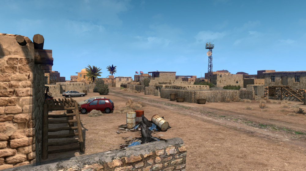
Halayeb Village, Halaib Triangle
Image

The Halayeb area is done.
Image

Exiting Halayeb Village
Image

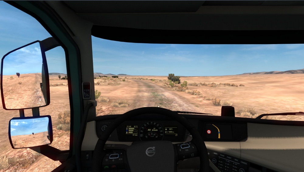
Driving through The Halaib Triangle
Image


Developer: Tedesco
Modeler: SlenderSmoke
Research: Hysteria

And of course with the help of the whole TerraMaps Team

Any comments are welcome!
Proc: i7-9750H 2,6 GHz (max. 4,5 GHz)
Mem: 16GB
Graphics: ASUS ROG -STRIX-RTX2060-O6G-GAMING 6 GB GDDR6
User avatar
BenganJ
Moderator
Posts: 9589
Joined: December 15th, 2018, 11:54 am
Location: Gothenburg, Sweden

Re: [REL]/[WIP] Red Sea Map 1.2. - (1.39/2.51) by TerraMaps

Post by BenganJ » January 24th, 2021, 2:17 pm

Oh, looking damn good! 👍👍👍
---------------------------------------------------------------------------------------------------------------------------------------------
System: Windows 8.1
Processor: Intel Core i7-4790@
Memory: 16GB
Graphics: ASUS GeForce GTX1660Ti
Image
User avatar
Tapir
VIP
Posts: 4176
Joined: December 15th, 2018, 3:07 pm
Location: Stratford, UK

Re: [REL]/[WIP] Red Sea Map 1.2. - (1.39/2.51) by TerraMaps

Post by Tapir » January 24th, 2021, 2:34 pm

Great !!!! :party:

System: Windows 11 PRO
Processor: Intel i7-12700KF 5GHZ
Motherboard: Gigabyte B760 DS3H AX
Memory: Corsair DDR5-6000 32 GB
Storage: Samsung 990 M2 SSD + 2 Samsung 870 SSD
Graphics: Asus GeForce Dual RTX 3060 V2 12GB GDDR6
User avatar
Sergey061
PPM
Posts: 342
Joined: December 27th, 2018, 4:59 pm
Location: Россия, Гуково
Contact:

Re: [REL]/[WIP] Red Sea Map 1.2. - (1.39/2.51) by TerraMaps

Post by Sergey061 » January 24th, 2021, 2:42 pm

Great and high quality work !!

Большая и качественная работа!!
Win-10 64bit,
ASUS ROG MAXIMUS XII FORMULA
Intel Core i-9 10900K ,5.3GHz
MSI Gaming X Trio GeForge RTX 3080
Система - 250 ГБ SSD M.2 Samsung 960 EVO
Игры - SSD SAMSUNG 860 QVO 1ТБ
память - CORSAIR Vengeance RGB Pro DDR4 - 4x8ГБ 4000 МГц
Rubenz
Posts: 8
Joined: January 1st, 2021, 1:33 pm

Re: [REL]/[WIP] Red Sea Map 1.2. - (1.39/2.51) by TerraMaps

Post by Rubenz » January 24th, 2021, 2:50 pm

Great Work!
xela1961
Posts: 179
Joined: October 18th, 2019, 1:56 pm

Re: [REL]/[WIP] Red Sea Map 1.2. - (1.39/2.51) by TerraMaps

Post by xela1961 » February 3rd, 2021, 1:36 pm

It is WOWWW...
User avatar
Ronin
VIP
Posts: 1502
Joined: October 17th, 2019, 11:16 am
Location: Gorinchem, Netherlands

Re: [REL]/[WIP] Red Sea Map 1.2. - (1.39/2.51) by TerraMaps

Post by Ronin » February 7th, 2021, 8:54 pm

[WIP] Red Sea Map 1.3 - Road to Safaga

Last time we showed screenshots of the end of the road to Sudan, the Halaib triangle.
But of course there is much more work to be done on the road to get from Hurghada to the Sudan border.
Forze has been recruited as the 2nd map developer for the Red Sea. This is his work on road to and the city of Safaga!
Enjoy it.

Jungle Hotel Park Resort in Hurghada on the left
Image

Road to Safaga!
Image
Image

Safaga's entrance
Image

Safaga's 2nd entrance
Image

Safaga
Image


Main Developer: Forze
Developer Manager: Tedesco
Research: Hysteria

And of course with the help of the whole TerraMaps Team

Any comments are welcome!
Proc: i7-9750H 2,6 GHz (max. 4,5 GHz)
Mem: 16GB
Graphics: ASUS ROG -STRIX-RTX2060-O6G-GAMING 6 GB GDDR6
User avatar
clear F1
VIP
Posts: 1164
Joined: January 23rd, 2019, 5:32 pm
Location: Nagoya, JAPAN
Contact:

Re: [REL]/[WIP] Red Sea Map 1.2. - (1.39/2.51) by TerraMaps

Post by clear F1 » February 8th, 2021, 8:40 am

Image

Looking good!
AMD Ryzen 7 7800X3D
ASRock X670E Taichi Carrara
DOMINATOR TITANIUM DDR5-7200 32GB
PNY RTX4070Ti 12GB VERTO LED WE
WD m.2 KIOXIA m.2
RonnieTuitL
PPM
Posts: 38
Joined: May 20th, 2020, 11:52 am
Location: Lemmer, the Netherlands

Re: [REL]/[WIP] Red Sea Map 1.2. - (1.39/2.51) by TerraMaps

Post by RonnieTuitL » February 8th, 2021, 3:01 pm

Great work, looking forward to it.
:i-m_so_happy:
User avatar
Ronin
VIP
Posts: 1502
Joined: October 17th, 2019, 11:16 am
Location: Gorinchem, Netherlands

Re: [REL]/[WIP] Red Sea Map 1.2. - (1.39/2.51) by TerraMaps

Post by Ronin » February 20th, 2021, 4:54 pm

[WIP] Red Sea Map 1.3 - The Red Sea coast

The last time I left you in Safaga on the Red Sea coast. But between Safaga and Halayeb, there is a long coastal road known as the Red Sea Riviera. Egypt's eastern coastline along the Red Sea, consists of resort cities on the western shore. The Cities you can visit are Quseer; Marsa Alam and Shalaten. But make no mistake. Most of the road is an empty desert. My advice is don't break down with your truck there. Help can take a long time. :grin:

Leaving Safaga
Image

In the beginning there will still be some trucks on the road.
Image

But soon after you will be alone with your truck. Enjoying the peace and quite.
Image

And when is gets dark, it reall gets dark and cold in the desert. (Yes this is een screenshot from the red sea :grin: )
Image

But finaly the next morning you will be at the border. Time to rest. (Sudanese side of the border-Rest Area)
Image


Main Developer: Tedesco
Developer: Forze
Research: Hysteria

And of course with the help of the whole TerraMaps Team

Any comments are welcome!
Proc: i7-9750H 2,6 GHz (max. 4,5 GHz)
Mem: 16GB
Graphics: ASUS ROG -STRIX-RTX2060-O6G-GAMING 6 GB GDDR6
Post Reply